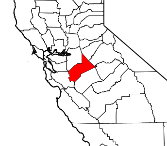
 Stanislaus County is a county located in the Central Valley of the U.S. state of California. As of the 2010 census, the population was 514,453 up from 446,997 at the 2000 census. The county seat is Modesto.
Stanislaus County is included in the Modesto Metropolitan Statistical Area.
History[edit]
The county is named for the Stanislaus River, first discovered by a European, Gabriel Moraga, in 1806, and later renamed Rio Estanislao in honor of Estanislao, a mission-educated renegade Native American chief who led a band of Indians in a series of battles against Mexican troops until finally being defeated by General Mariano Vallejo in 1826. Estanislao was his baptismal name, the Spanish version of Stanislaus, itself the Latin version of the name of an 11th-century PolishCatholic Saint Stanislaus the Martyr.
Between 1843 and 1846 when California was a province of independent Mexico, five Mexican land grants of a total of 113,135 acres (457.8 km2), or over forty-four square miles were granted in Stanislaus County. Rancho Orestimba y Las Garzas, Rancho Pescadero and Rancho Del Puerto were located on the west side of the San Joaquin River. Rancho Del Rio Estanislao and Rancho Thompson were on the north side of the Stanislaus River. Additionally in 1844, Salomon Picoreceived a Mexican land grant of 58,000 acres (230 km2) in the San Joaquin Valley, somewhere near the Stanislaus River and the San Joaquin River in what is now Stanislaus County. However the grant was never confirmed by the Land Commission.[1]
Stanislaus County was formed from part of Tuolumne County in 1854.The first county seat was situated at Adamsville, then moved to Empire in November, then to La Grange in December, then to Knights Ferry in 1862, and definitely fixed at the present location in Modesto in 1871.
As the price of housing has increased in the San Francisco Bay Area, many people who work in the southern reaches of the Bay Area have opted for the longer commute and moved to Stanislaus County for the relatively affordable housing.
Pronunciation of the county’s name[edit]
There has been a somewhat lively local speculation on the pronunciation of the name Stanislaus. Some locals pronounce it STAN-ěs-läw, without a final S. This is undoubtedly influenced by the Spanish version Estanislao and further followed by the fact that the San Joaquin Valley was settled by immigrants from the southern states after the Civil War, and the southern dialect tends to soften all following consonants. Despite this, the silent final S has never been universal, and other ethnic and historical influences tend to argue over it. Several towns in Stanislaus and other counties along the Stanislaus River, including Turlock, Valley Home, and Ripon, were founded and settled by immigrants from Danish, Dutch, German-speaking areas where Stanislaus is a typical surname and masculine given name, and like Estanislao, a variation of Stanley. The German pronunciation, STAN-ĭs-lŏss, retains the trailing S and puts some emphasis on the second syllable. However, regardless of the name’s exact local history, most non-locals and newcomers pronounce Stanislaus with the final S, which is arguably the more phonetically intuitive method, but both pronunciations are claimed to be official.
Stanisławów was founded as a fortress in 1650 in Europe and was named after the Polish hetman Stanisław “Rewera” Potocki, although other sources claim it was named after his grandson (see History of Ivano-Frankivsk). In 1772 its name was transliterated into German as Stanislau when it became part of the Austrian Empire and later Austria-Hungary; however, after the revolution of 1848 the city carried three different linguistic renderings of its name: German, Polish, and Ruthenian (German: Stanislau; Polish: Stanisławów; Ukrainian: Станиславів, Stanyslaviv). Other spellings used in the local press-media included: Russian: Станиславов and Yiddish: סטאַניסלאוו.
Geography and environment[edit]
According to the 2000 census, the county has a total area of 1,514.67 square miles (3,923.0 km2), of which 1,493.79 square miles (3,868.9 km2) (or 98.62%) is land and 20.88 square miles (54.1 km2) (or 1.38%) is water.[2] There are a number or rare and endangered species found in Stanislaus County. The Beaked Clarkia, (Clarkia rostrata), is listed as a candidate for the Federal Endangered Species List. It has only been found in blue oak–Digger Pine associations in the foothills of the Sierra Nevada, a habitat which occurs at moderately high elevations. Colusa Grass, (Neostapfsia colusana) is listed as endangered by the State. It is restricted to vernal pools. (Torrey, 1989)
Stanislaus County has historically been divided socially and economically by the north-flowing San Joaquin River, which provided a natural barrier to trade and travel for much of the county’s history. Isolated from the main rail corridors through the county and the irrigation projects that generated much of the region’s economic prosperity, the part of Stanislaus County west of the river (known to locals as the “West Side” of the county) has largely remained rural and economically dependent on agricultural activities. Because of its proximity to Interstate 5 and the California Aqueduct some towns within this area, including Patterson and Newman, have experienced tremendous growth and are being transformed into bedroom communities for commuters from the nearby San Francisco Bay Area, while others (including Westley and Crows Landing) have been almost entirely overlooked by development and remain tiny farming communities.
Provided by Wikipedia